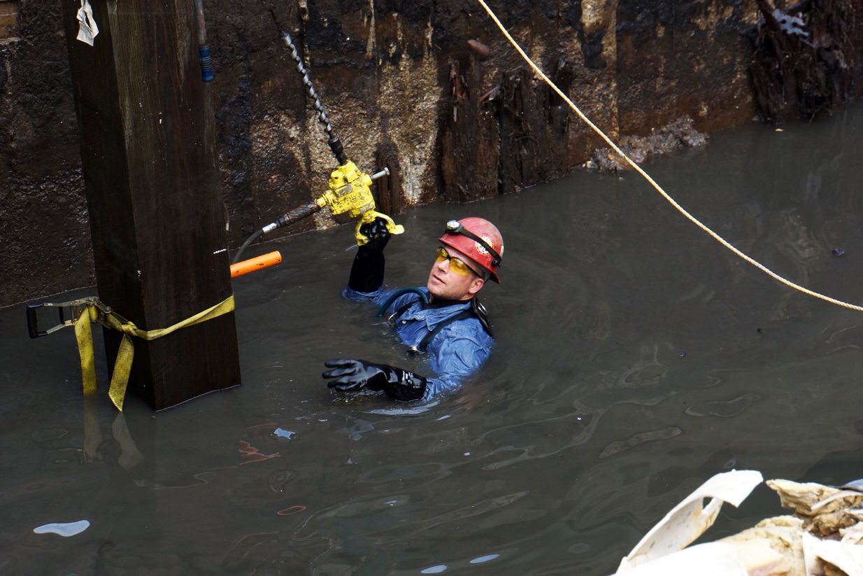
These guys are swimming on land. Or, more precisely, on landfill.
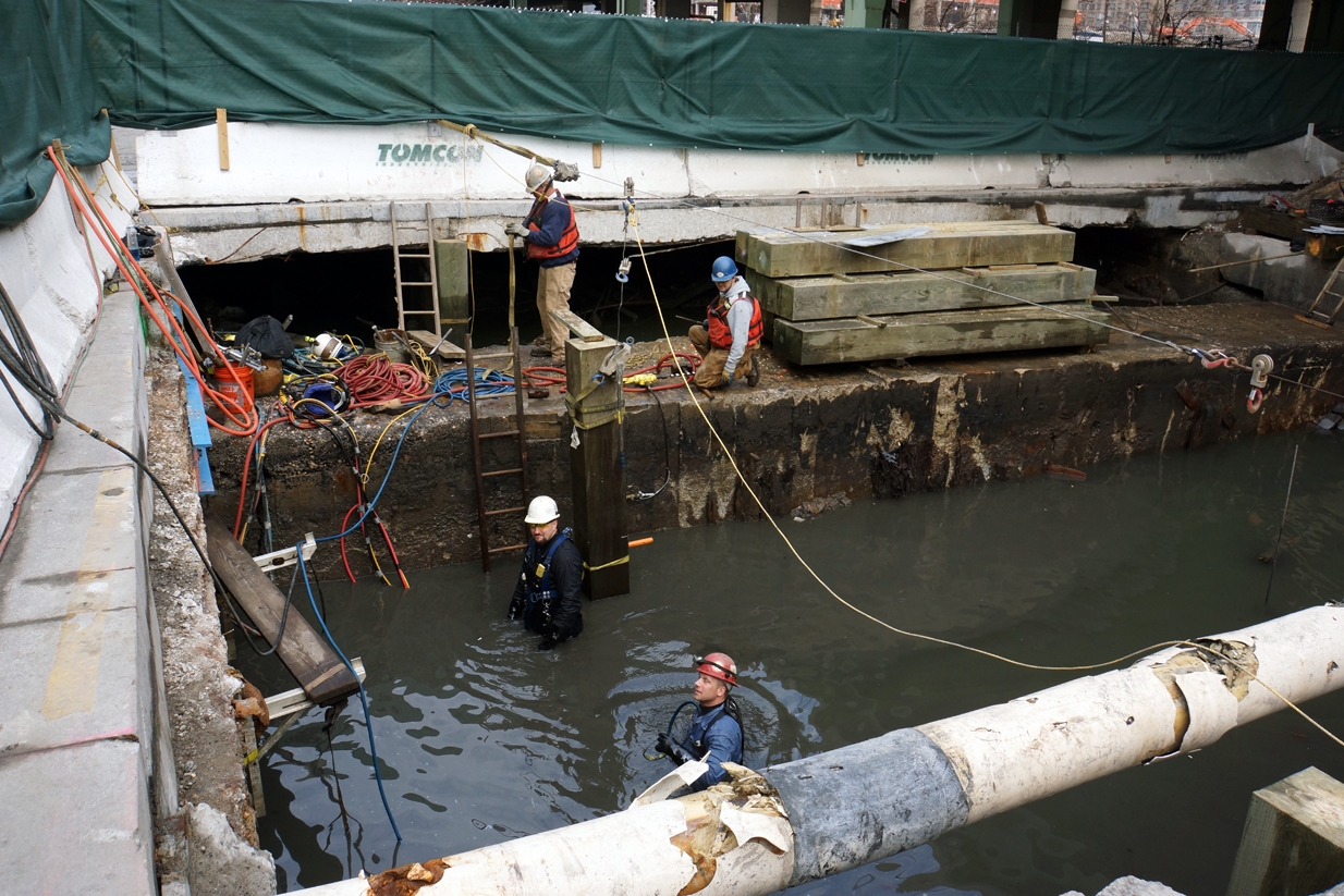
Men working in the Hudson River/59th Street
And, on an unseasonably warm December day, they seemed to be enjoying themselves as they went about their business repairing giant piles that help support a roadway that’s shared (and not always so nicely) by joggers, bikers, bladers, pedestrians, baby strollers, cars and giant garbage trucks on West 59th Street. Let me illustrate this spot a bit more clearly:
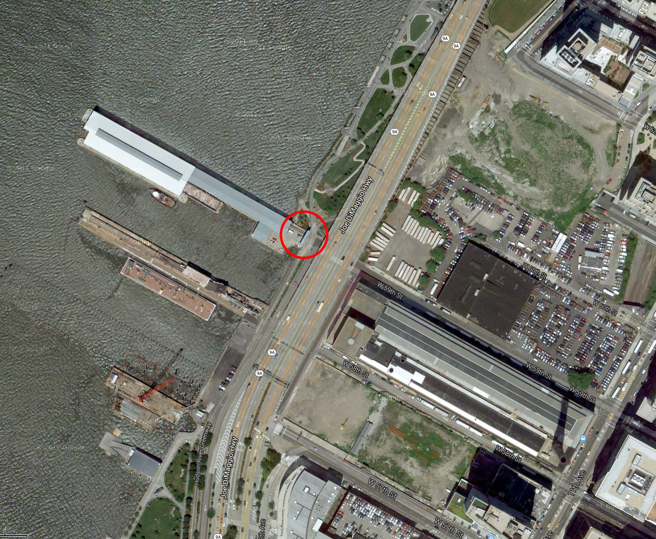
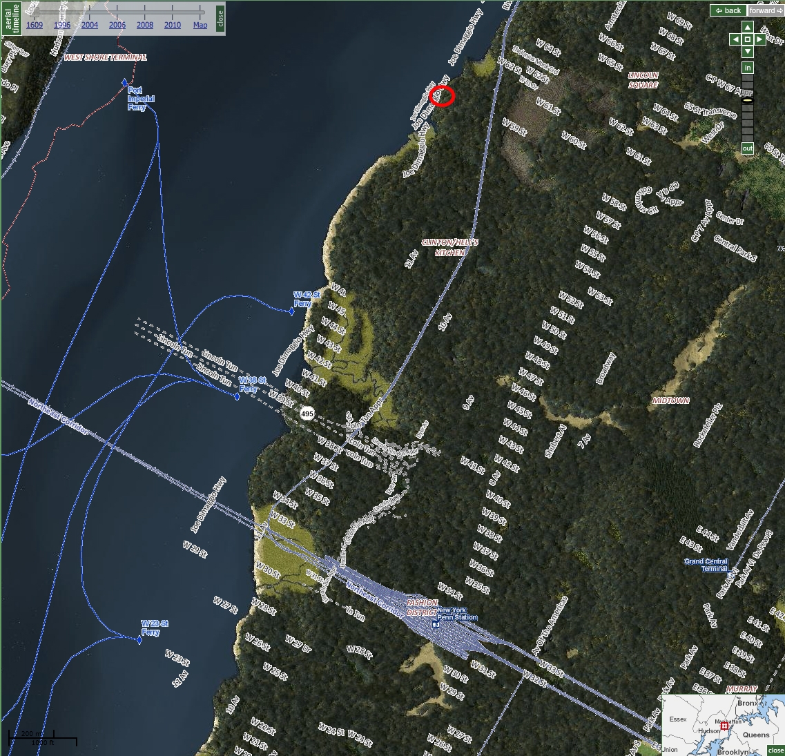
West 59th Street, courtesy Google Maps
I was riding my bike downtown when I stopped to see what was going on. After being told about the pile repair, I remarked that we humans are re-asserting our claim to this patch of “land” once occupied by the Hudson River. One of the workers replied that the Hudson River was actually the one doing the reclaiming. It was, after all, part of its watery domain before we came along and started filling in the edge of our prosperous island. Have another look at the same spot, courtesy of Oasis, the mapping organization that works in cooperation with the Center for Urban Research at CUNY to provide the richest source of community maps for New York City (as always, click an image to enlarge it):
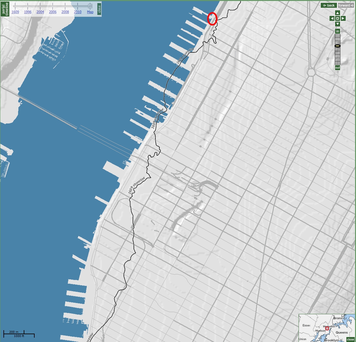
Manhattan Island with the 1609 shoreline. Courtesy of Oasis & the Mannahatta Project.
Oaisis teamed up with the extraordinary folks at the Mannahatta and Welikia Projects and incorporated their data on historical land use into the Oasis maps, including soil types, ponds and streams, and habitat areas for beaver, black bear, gray wolf, mountain lion and many other animal species. In the map above, I selected the mask for the 1609 shoreline, which you see represented with a little black squiggle that runs parallel to the Hudson River. (Rail fans and High Line lovers will also note the loop of the Hudson Rail Yards a bit to the south.) This line denotes the edge of the island that Henry Hudson discovered in 1609. The little red circle shows where the pile-fixers were working at the western-most edge of 59th Street. Back in Hudson’s day, this was probably an oyster-rich beach.
The Oasis map also allows you to view the island in its wild state by sliding the “aerial timeline” all the way back to 1609. They’ve used the Mannahatta’s Project evocative rendering of a wooded island with many lakes, streams, and wetlands, which was based on massive amounts of data and research. You can overlay the modern street grid and a host of other contemporary data if you like, including social services, transportation, parks, and more. In the version below you might really wonder “Where have you gone, Joe Dimaggio?” as the highway bearing his name is suddenly running right through the Hudson River. Again, my red circle shows the spot where the men were working on the piles.
Mannahatta Project’s aerial representation of Manhattan Island in 1609, with modern data overlaid
We Manhattanites strut around like we own the place, but sometimes we are pointedly reminded that we’re just a bunch of clever interlopers. I’ll be writing soon about the Lenape Indian trails that Welikia and Oasis also display in their masking options, and will show how these historic pathways intersect with the High Line. If you like, you can subscribe to this blog and get new posts delivered automatically by email or RSS — just click here.
“This land is your land, this land is my land….”